The raster package defines object used to raster maps (online or stored map)
|
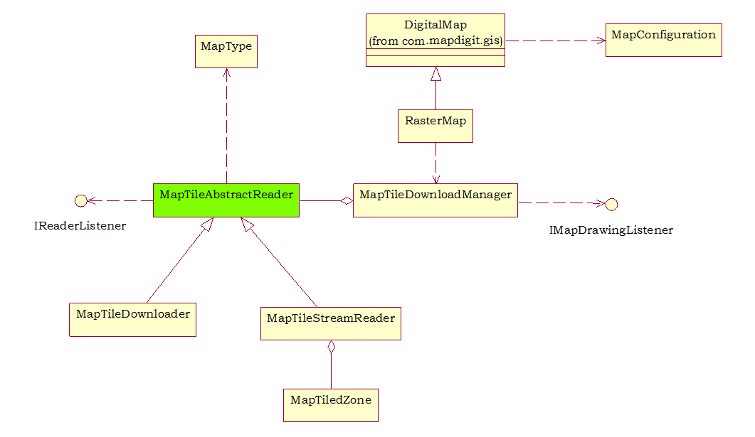
Map Type
|
Define different map types (Google, Microsoft Live, Yahoo etc).
|
|
MapConfiguration
|
To fit for different device capability (memory size, screen size), the Map API can be configured to turn on/off cache, drawing routing polyline or not etc).these configuration will effect memory usage and performance of the Map API.
|
|
RasterMap
|
A core map class used to display map from server or from stored map file, provide panning, zooming etc.
|
|
MapTileAbstractReader
|
An abstract class defined how map tiles is obtained, connecting to map server, reading from local map files or rendering the vector map.
|
|
MapTileDownloader
|
MapTileDownloader download map image tiles from server (msn, yahoo, etc).
|
|
MapTileStreamReader
|
Read map image tiles from a input stream (mostly from local map file)
|
|
MapTileZone
|
A predefined stored map file. Developer can define their own stored map file format, if only it derives from MapTileAbstractReader.
|
|
IReaderListener
|
A listener used to monitor the progress of the reading
|
|
IMapDrawingListener
|
When a map reader finish downloading/reading/rendering a map tile, it trigs the listener to notify a map tile is available.
|

Leave a comment