Package Gis define some common Map Objects:
|
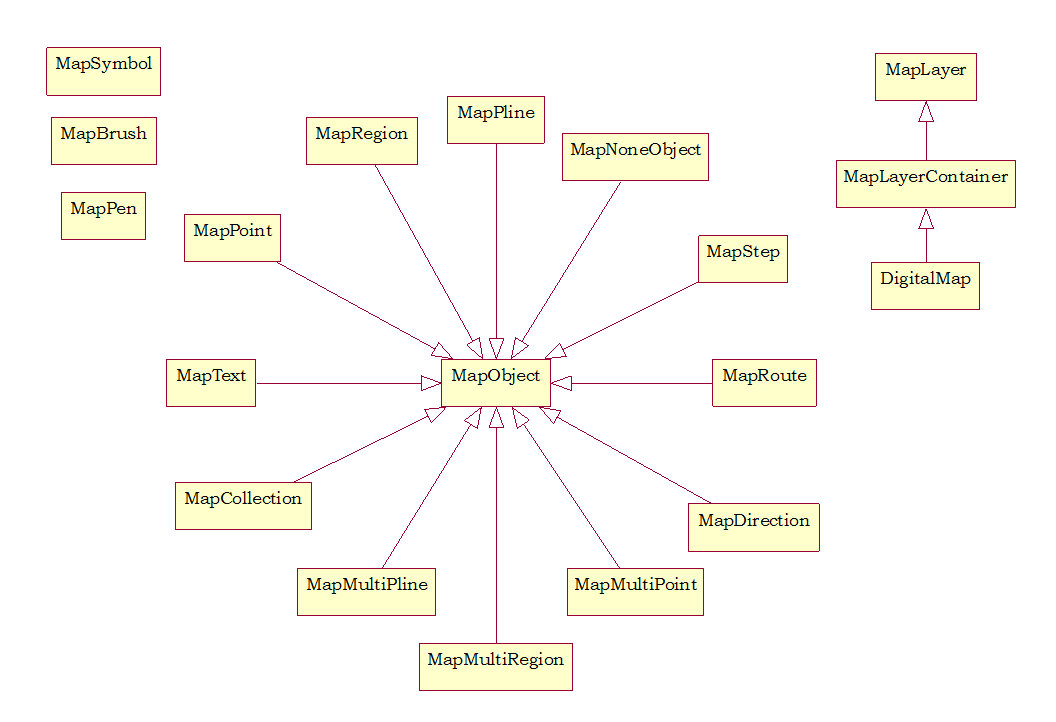
MapDirection
|
This class is used to store driving directions results
|
|
MapObject
|
Base class of all map objects.
|
|
MapPoint
|
Class MapPoint stands for a point map object.
|
|
MapRoute
|
Objects of this class store information about a single route in a directions result.
|
|
MapStep
|
Objects of this class store information about a single step within a route in a directions result.
|
|
DigitalMap
|
DigitalMap is the base class for Raster Map and Vector Map..
|
|
MapSymbol
|
Map symbol used to display a point.
|
|
MapPen
|
Map pen used to draw a map object.
|
|
MapBrush
|
Map brush used to paint a map object.
|
|
MapPoint
|
Class MapPoint stands for a point map object.
|
|
MapPline
|
Class MapPline stands for a map pline object.
|
|
MapRegion
|
Class MapRegion stands for a map region object.
|
|
MapMultiPoint
|
Class MapMultiPoint stands for map points’ collection.
|
|
MapMultiPline
|
Class MapMultiPline stands for map plines’ collection.
|
|
MapMultiRegion
|
Class MapMultiRegion stands for map regions’ collection.
|
|
MapCollection
|
Class MapCollection stands for a collection of map objects.
|
|
MapNoneObject
|
Class MapNoneObject stands for a map object without geo info.
|
|
MapText
|
Class MapText stands for a text map object.
|
|
MapLayer
|
Base class for a map layer.
|
|
MapLayerContainer
|
A container for map layers, support add, move, delete map layers.
|

Leave a comment