guidebee

January 7, 2011

Guidebee Map API –Package Gis.Geometry

Filed under: Mobile Map API,Uncategorized — guidebee @ 3:45 pm

This package defines geographical geometry objects, like polygon, point, polyline etc


GeoBounds
GeoBounds is a rectangular area of the map in pixel coordinates
GeoLatLng
GeoLatLng is a point in geographical coordinate’s longitude and latitude.
GeoLatLngBounds
GeoLatLng is a bound in geographical coordinate’s longitude and latitude.
GeoPoint
A point representing a location in (x, y) coordinates space, specified in integer precision.
GeoPolygon
Polygon on map.
GeoPolyline
Polyline on map.
GeoSize
The GeoSize class encapsulates the width and height of a component (in integer precision) in a single object.

Guidebee Map API –Package Gis

Filed under: Mobile Map API,Uncategorized — guidebee @ 3:40 pm

Package Gis define some common Map Objects:


MapDirection
This class is used to store driving directions results
MapObject
Base class of all map objects.
MapPoint
Class MapPoint stands for a point map object.
MapRoute
Objects of this class store information about a single route in a directions result.
MapStep
Objects of this class store information about a single step within a route in a directions result.
DigitalMap
DigitalMap is the base class for Raster Map and Vector Map..
MapSymbol
Map symbol used to display a point.
MapPen
Map pen used to draw a map object.
MapBrush
Map brush used to paint a map object.
MapPoint
Class MapPoint stands for a point map object.
MapPline
Class MapPline stands for a map pline object.
MapRegion
Class MapRegion stands for a map region object.
MapMultiPoint
Class MapMultiPoint stands for map points’ collection.
MapMultiPline
Class MapMultiPline stands for map plines’ collection.
MapMultiRegion
Class MapMultiRegion stands for map regions’ collection.
MapCollection
Class MapCollection stands for a collection of map objects.
MapNoneObject
Class MapNoneObject stands for a map object without geo info.
MapText
Class MapText stands for a text map object.
MapLayer
Base class for a map layer.
MapLayerContainer
A container for map layers, support add, move, delete map layers.

Guidebee Map API packages

Filed under: Mobile Map API,Uncategorized — guidebee @ 4:50 am

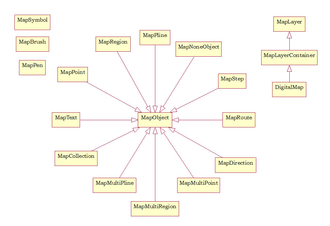
Below is the core classes defined in the Map API

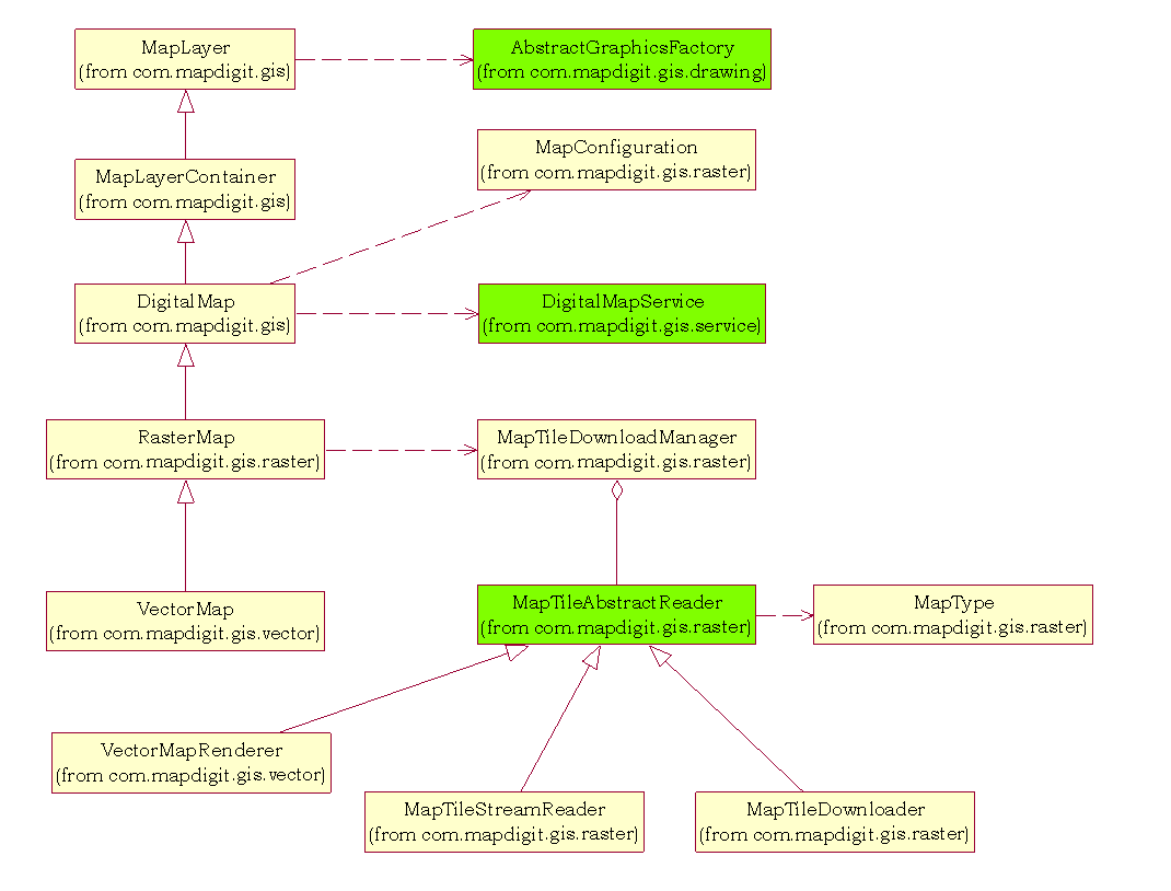
The classes in green in above diagram define base classes to support different UI frameworks on different platforms, different map type support and to support different map services.

The Guidebee Map API design made two abstractions for the map type (the map images) and map services (Geocoding, routing etc).
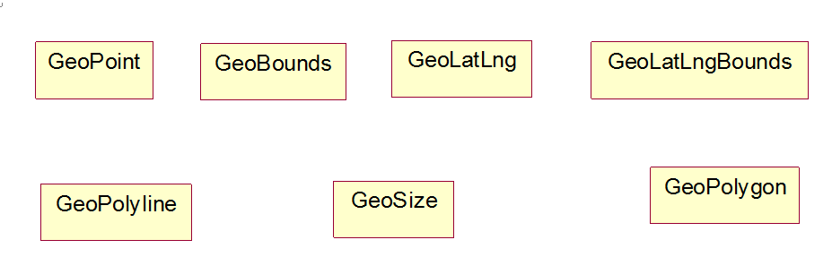
The map type is the map images; it comes from 3 different sources:
 Online map, it connects to map servers (like Yahoo map, Microsoft Live Map etc) and display map image.
 Offline map (or stored map), allow access self defined map image file locally to avoid data traffic to server.
 Vector map, it supports MapInfo compatible map data and provide similar functionalities as MapInfo map product.

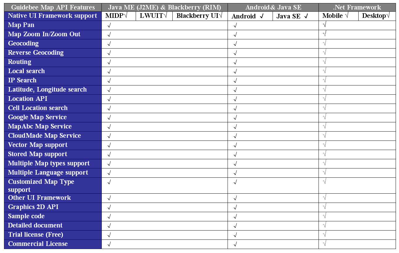
While the Map services refer to Geocoding, Reverse Geocoding, Routing, Local Search etc, Guidebee Map API internally support Google Map service, CloudMade Map Service, if in China also support MapAbc Map services. The other map services like Bing Map or Yahoo Map may be included in future releases.

Since Map Type (map images) and Map Services (Routing, Geocoding etc) are relatively independent with each other, you can display Google Map and using CloudMade Map services or show Bing Map China and use MapAbc map services. It provides such flexibility for developers to cater for different circumstances.


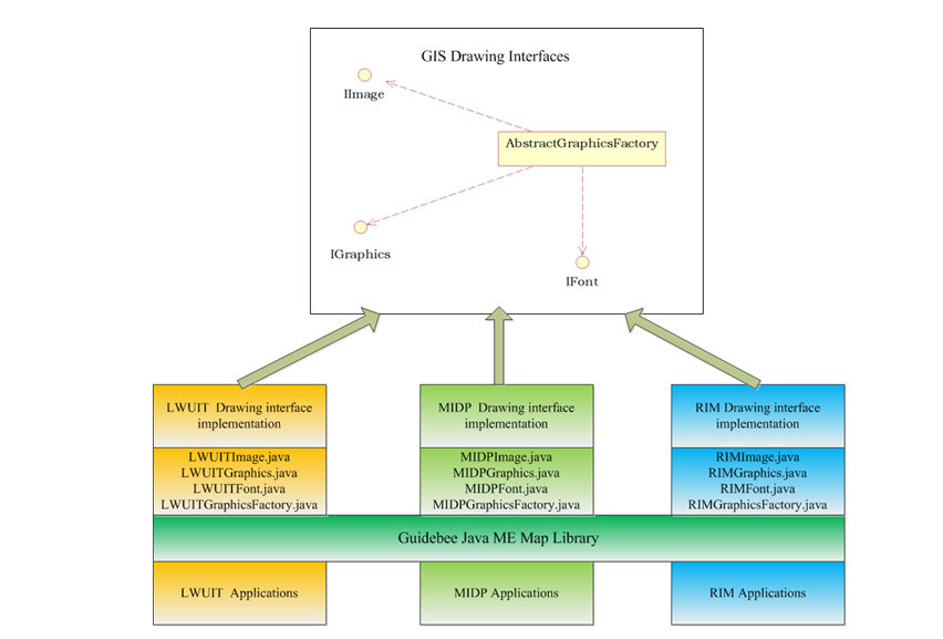
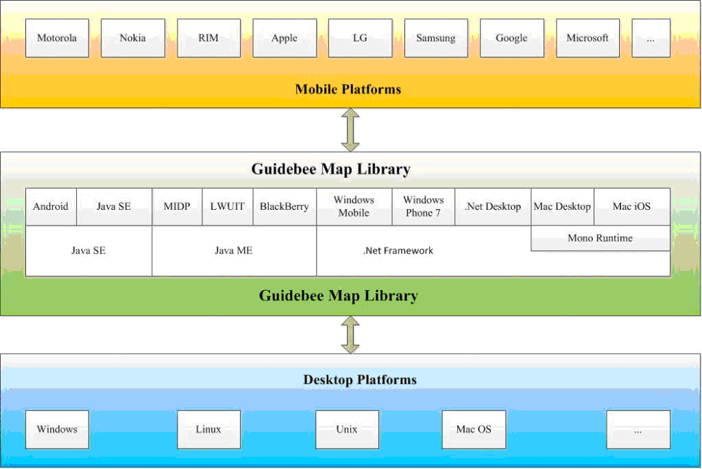
An abstract Graphics system is defined in Guidebee Map API and it’s used to support different Graphics systems on different platforms. In package Gis.Drawing, IImage, IGraphics, IFont, AbstractGraphicsFactory are defined as interface or abstract class. In this way, the same binary with platform dependant implementation works on different platforms.

For instance, On Java ME platform, developer can choose MIDP’s LCDUI or Sun’s LWUIT or choose Blackberry UI framework for RIM devices.

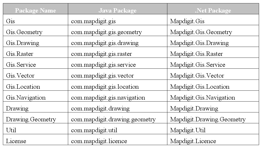
Java and C# (.Net Framework) are two major languages supported by Guidebee Map API. Though Java and C# are different, but there’s nearly one to one mapping between two languages for the Map API, if you know one, you’ll be quite familiar with the other.

Here’s the list of the major packages defined within Guidebee Map API.

January 6, 2011

Guidebee Map API 2.1 Overview

Filed under: Mobile Map API,Uncategorized — guidebee @ 3:58 pm

Speaking of Map API, the Google map API and Bing Map API probably are the most popular ones available to developers, but they mainly work with web applications requires online network and for example it’s not very convenient to write applications on Java ME platform with Google Map and it’d be difficult to work with Bing Map on Android or iPhone devices.

Guidebee Map API supports all most every platform on the market, either desktop or mobile platforms and with consistent APIs; you can use more than 20 different map types includes Google Map, Bing Map, and Yahoo Map ,offline map and vector map with the same API package.

The following diagram shows the platforms Guidebee Map API supports. The API is provided as three different binaries to target all platforms.

  • Java ME library MIDP/LWUIT/Blackberry
  • Java SE library Android/Java SE
  • .Net framework library Windows Mobile/Desktop/Windows Phone 7

  For Mac OS/iPhone/iPad (with support of Mono, MonoTouch )

 
Major features defined in Guidebee Map API are shown in following table:


Note: support for Mac OS, iPhone, iPad requires Mono, MonoTouch.


For more information, please visit http://www.guidebee.biz/
« Previous Page

Blog at WordPress.com.

Design a site like this with WordPress.com
Get started